Project Overview
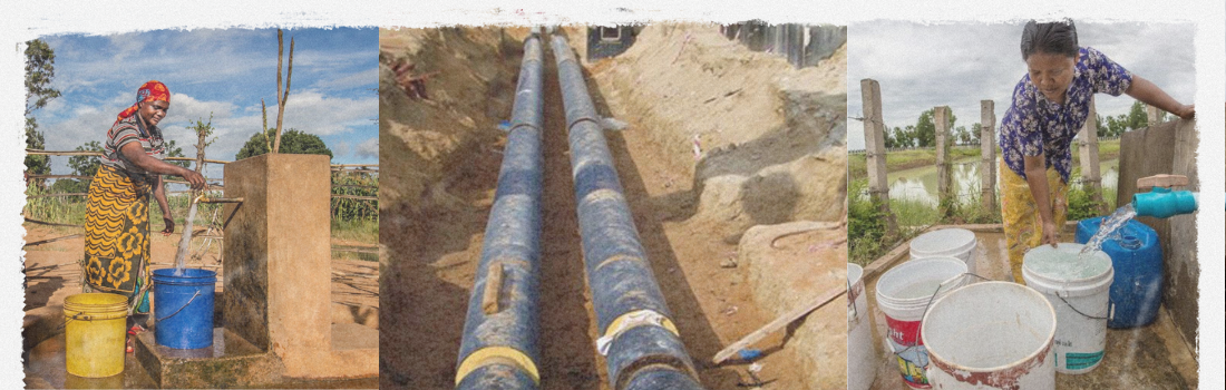
Mapsets was commissioned by the Government of Karnataka, under a World Bank-aided program, to develop a complete GIS-based rural water supply system for 150 villages across Mysore and Mandya districts. The project focused on providing safe, sustainable, and scientifically designed potable water systems, covering both surface and groundwater sources.
It included full-scale hydrological surveys, water quality analysis, infrastructure planning, and village-level mapping, linked to population growth projections and design discharge calculations.
Core Innovations & Achievements
- House-to-house population census and water use survey
- GPS-linked mapping of water sources: hand pumps, power pumps, rivers
- Potability testing: I-coli, discharge volume, water depth
- Contour mapping and leveling at 1:1000 and 1:5000 scales
- Hydraulic modeling for LPCD (Liters Per Capita Per Day) per village
- Clubbed village planning for shared infrastructure & OHTs
")
Technologies & Methodologies Used
- AutoCAD for mapping water networks & pipelines
- GIS dashboards for multi-village system design
- Satellite imagery interpretation for river proximity & elevation
- Schlumberger method & resistivity meters for borewell success rate
- Open-pit tests and SPT for geotechnical evaluation
- LISPs for design loss computation and water demand forecasting
Enabling Last-Mile Water Access
This project laid the foundation for a sustainable rural water supply model that ensured potable water access to over 150 villages. The success rate of borewell identification exceeded 75%, and the system was designed to serve till 2020 and beyond, factoring in population growth and seasonal stress.
The approach was recognized by the World Bank and Government of Karnataka for its precision, scientific rigor, and community-level adaptability.