Project Overview
Mapsets developed and implemented a full-scale AgriTech Monitoring System in Uttar Pradesh, focusing on real-time soil testing, carbon credit audits, and subsidy tracking under government programs. This multi-year initiative integrates GPS-tagged cadastral maps, IoT soil sensors, and a custom Management Information System (MIS) that monitors farm-level data, soil runoff, and the actual impact of conservation structures.
With over 27 crore people impacted, this is one of India’s most ambitious precision agriculture initiatives.
Key Deliverables & Innovations
- Individual cadastral soil analysis using GPS
- Site-specific soil testing & digital fertility mapping
- Real-time MIS platform for tracking ₹1,500+ Cr in subsidies
- Farm-to-cloud integration using mobile soil testing kits
- Carbon credit calculation via field-based data
- QR-coded seed-to-yield tracking linked with government dashboards
")
Technologies & Methodologies Used
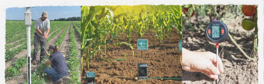
- IoT sensors for soil moisture, NPK, EC, and pH
- Mobile soil sampling kits with app sync
- GPS-based field-level mapping & ground truthing
- Satellite imagery overlays for runoff and erosion
- Blockchain for seed traceability
- Machine learning for yield forecasting and subsidy effectiveness
Transforming Agri Governance Through Data
Mapsets’ integrated platform empowered the Government of Uttar Pradesh to track fertilizer impact, optimize soil health planning, and monitor environmental gains such as carbon sequestration. This project is now being evaluated for national rollout and has become a reference model for data-driven governance in agriculture.